
Did You Feel It?
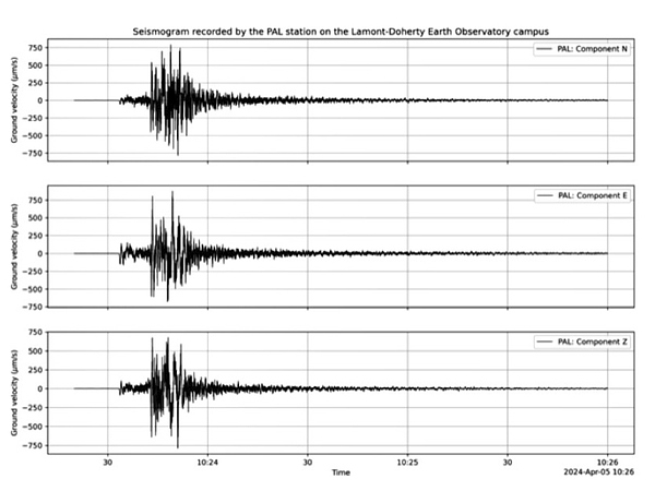
When the magnitude 4.8 earthquake rattled the N.Y. Metro area on Friday, April 5 at 10:23 am ET, Lamont-Doherty Earth Observatory seismographs and seismologists were shook! Among the events to follow was a magnitude 3.8 aftershock at approximately 6:00 pm ET.
Historically, the largest known earthquake on the Ramapo system took place in 1957 and had a magnitude of 3.8, "so this is large and significant," says Lamont geologist Folarin Kolawole, who was in class discussing faults and their breaks when the earthquake hit. Kolawole and his students decided to estimate the magnitude based on the duration and their impressions of the strength of the shaking, coming close with their estimate of magnitude 5.
Lamont geodesist James Davis, head of the seismology, geology and tectonophysics research division, says the crust of the Appalachian region is old, cold and brittle, making it good at transmitting the waves of violent shaking, which radiate outward from the central fracture in the deep bedrock. Geodesy is the science of measuring and understanding the Earth's geometric shape, orientation in space and gravity field.
Seismologists say that large earthquakes in this area are rare. A 2008 study by Lamont experts Lynn Sykes, John Armbruster, Won-Young Kim and Leonardo Seeber found that a magnitude 5 earthquake occurs in the region about once per century, a magnitude 6 plus about once every 670 years, and magnitude 7 about once every 3,400 years.
To learn more about Lamont's earthquake research, visit lamont.columbia.edu.